


Log in
How Accurate Is Land Portal's Property and Owner Data?
For a land investor, the data is the business. Every decision you make sits on top of it.
Is this parcel actually vacant? Does it touch a road? Who owns it, and where does their mail actually go? Get those answers right, and the rest of the deal is math.
Land Portal was built by land investors to solve that problem, and accuracy is the thing the whole platform is engineered around.
It shows up in how the data is sourced, how often it’s refreshed, and how tightly it’s filtered before it ever reaches you.
Here’s a feature-by-feature look at what makes the property and owner data reliable.
Multi-Source Property Data
Accurate data starts with good sources, and it starts with more than one.
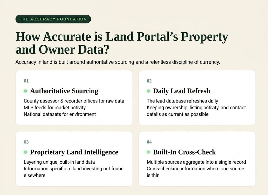
The platform aggregates records from the authoritative places property data actually lives: county assessor and recorder offices for ownership and parcel detail, MLS feeds for listing and sale activity, and national datasets for physical and environmental attributes.
Land Portal combines data from multiple trusted sources into a single property record and makes the picture complete: where one source is thin, another fills the gap, and the overlap acts as a built-in cross-check.
Then comes the part that sets it apart.
On top of that aggregated base, Land Portal layers its own proprietary land intelligence, information built specifically for land investing that simply isn’t available anywhere else.
That’s the difference between a generic property database and something purpose-built for the way land deals actually work.
Investors consistently point to this combination of aggregated authoritative records plus proprietary land intelligence as the reason the data holds up in the field.
Daily Data Refreshes
Property data is only valuable if it’s up to date. That’s why Land Portal refreshes ownership information, listing activity, and contact data regularly, helping ensure you’re working with the most current information available.
When you build a mailing list, accurate data matters. An outdated owner record or mailing address can mean wasted mail, missed opportunities, and unnecessary costs. Keeping property and owner data current helps you spend more time reaching the right landowners and less time cleaning up bad data.
AI Vacant Lot Detection
This is the flagship, and it earns the billing.
Mailing a lot you think is empty only to find out later it has a house on it is one of the most common and expensive mistakes in land: you’ve wasted postage, wasted skip traces, a lead list padded with parcels that were never candidates.
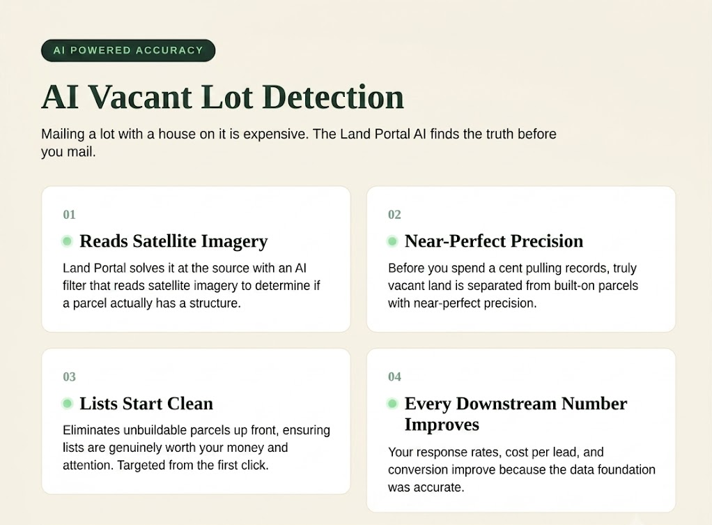
Land Portal solves it at the source with an AI Vacant Land Filter that reads satellite imagery to determine whether a parcel actually has a structure on it.
Think about what that does to a campaign. Before you spend a cent pulling records, the truly vacant land is already separated from the built-on parcels with near-perfect precision.
Your list starts clean. Every downstream number, response rate, cost per lead, and conversion improve because the foundation underneath it was accurate from the first click.
Advanced Land Filters for Precise Targeting
Vacancy is just the beginning. The real targeting power is in the land-specific filters stacked on top:
• Landlocked detection tells you whether a parcel has legal access, so you never chase land nobody can reach.
• Road frontage filtering lets you set a minimum and maximum in feet, which is gold for subdivide strategies.
• Wetlands, FEMA flood zones, and slope filters flag the physical realities that make or break buildability, drawn from authoritative federal and elevation datasets.
• Soil and terrain layers round it out.
Here’s the accuracy payoff most platforms can’t match: you apply all of this before you pay for data.
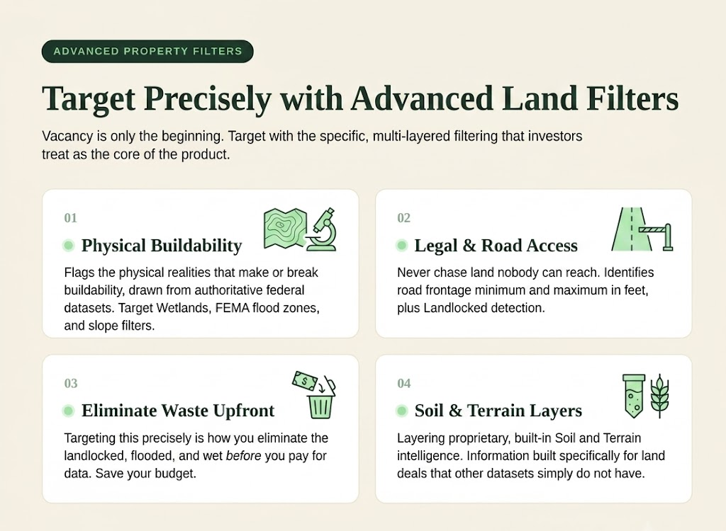
You’re not buying a pile of records and then discovering half of them are unbuildable, you’re eliminating the landlocked, the flooded, and the wet up front, so the parcels that survive the filter are the ones genuinely worth your money and attention.
The ability to target this precisely is a large part of why so many investors consider the land-specific filters one of Land Portal’s biggest advantages..
Owner Information and Portfolio Search
Accurate owner information is just as important as accurate property data. Land Portal includes the owner’s name, mailing address, and key property details in every record, making it easier to build targeted mailing lists and reach the right landowners.
You can also filter by criteria like out-of-state and absentee owners to focus on the properties that best match your investment strategy. Because the data comes from authoritative county records and is refreshed regularly, you can have greater confidence in the lists you’re building.
Portfolio Owner Search takes it a step further. Find one owner, and you can instantly see every parcel they own, helping you uncover additional opportunities and identify larger landowners who may be worth contacting directly.
When you’re ready to launch a campaign, batch exports let you quickly export clean, organized owner lists that are ready for your mail house, CRM, or other marketing tools.
Skip Tracing With Built-In DNC Compliance
Finding a good property is only half the job. Reaching the human is the other half, and it’s handled on the same screen.
One click on the property card runs a skip trace and returns available phone numbers and email addresses without ever leaving the map.
And it’s built with compliance baked in: skip traces come with free Do Not Contact scrubbing, so your outreach list is cleaned against DNC exposure automatically.
That’s a genuine cost and risk removed from your process, handled for you, at no extra step.
Integrated MLS Comps
Pricing land accurately is one of the hardest parts of the business, and integrated comps take the guesswork down.
Land Portal pulls active and sold MLS listings into the same environment as the standard property record, viewed side by side, exported together, all integrated.
Users routinely note that it’s the rare platform where you can export MLS comps with your property records in one motion rather than juggling separate tools and reconciling them by hand.
Real listing and sale data, sitting right next to the parcel you’re evaluating, means the market context is there when you need to price an offer with confidence.
AI-Powered Property Reports
For the moments you want a fast, structured read on a parcel, the AI report delivers one.
It produces automated land analysis on demand: a slope assessment that surfaces terrain and development considerations, a comparative market analysis that positions the property against similar listings, and an LP Estimate that estimates potential sale price from market and property data.
It’s a genuine accelerant, a well-organized first read that helps you triage opportunities quickly and decide where to spend your deeper diligence. It pairs naturally with the land investing education built into the platform, so the analysis and the know-how to act on it live in the same place.
Interactive Mapping & Verification
The last accuracy feature is the one that lets you trust everything else with your own eyes.
The interactive map is the heart of the platform: parcel overlays, high-resolution NAIP aerials, satellite and street map layers, and 3D terrain you can tilt and explore. Google Street View launches right inside the app, so you can scout a parcel’s access, frontage, and surroundings without ever opening another tab.
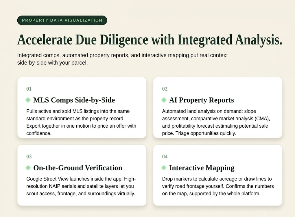
Measurement tools let you drop markers to calculate acreage or draw a line to check road frontage yourself, confirming the numbers directly on the map.
This is what turns good data into confident decisions. You’re never asked to take a figure on faith. You can see the parcel, walk its edges virtually, and verify what the record tells you against what the imagery shows.
Every subscription includes the mobile app, so that same verification power comes with you into the field, on the drive, standing at the property line.
The Verdict on Accuracy
So how accurate is Land Portal’s property and owner data? Accurate where it counts, and built to stay that way.
the AI Vacant Land filter and land-specific property data are precise enough to target hard against. The ownership data comes from authoritative county records and stays current through daily refreshes.
Skip-traced contacts arrive DNC-scrubbed and ready to work. MLS comps bring real market data into the same view as the parcel. And the interactive mapping lets you confirm any of it with your own eyes before you commit a dollar.
Accuracy in land is about whether every layer, the parcel, the owner, the access, the value, lines up with the dirt when you go look. It’s why land investors trust it to point them at the right land, the right owner, and the right deal.

Your Premium Source For Real Estate Data
© Copyright 2026 Land Portal – All Rights Reserved